Dock access blocked by cattails
Approach lanes narrow to one side, and residents end up stepping through heavy growth to tie off or launch.
Water Raptor clears the shoreline zones Utah property teams rely on most, including dock lanes, ramp entries, and inspection paths that disappear once cattails and reeds thicken up. We prioritize high-use corridors first so day-to-day operations recover before broader edge cleanup starts.
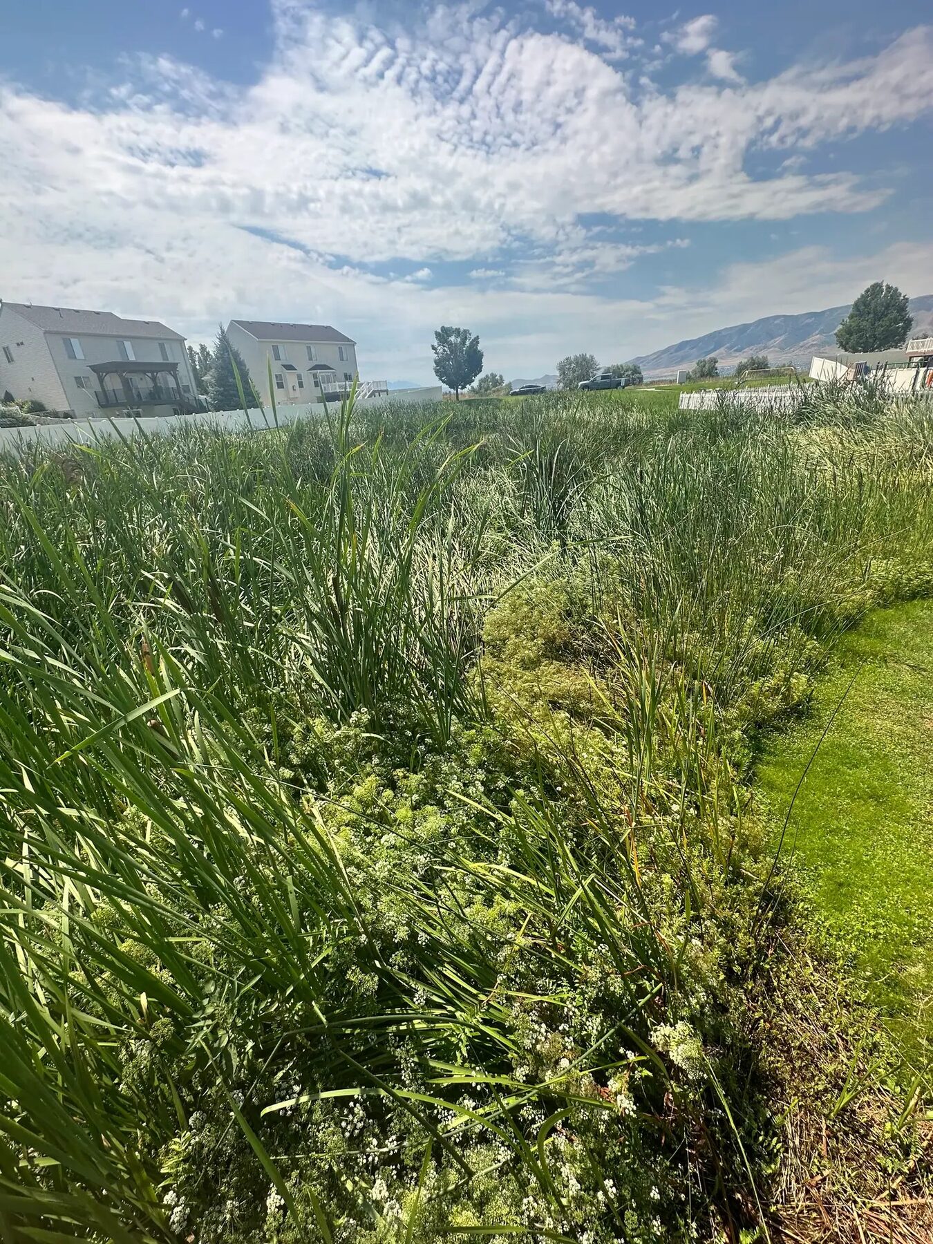
Access problems that show up in real operations, not just in photos after growth peaks.
Approach lanes narrow to one side, and residents end up stepping through heavy growth to tie off or launch.
Ramp corners and shallow entries fill in first, forcing awkward turns and reducing safe trailer alignment.
Routine inspection routes get pushed inland or skipped entirely when edge growth takes over trail lines.
Vegetation growing over intake structures, reducing flow and access for maintenance.
Channel openings restricted by encroaching edge growth reducing flow capacity.
Perimeter growth that prevents inspection, maintenance, and emergency access.
We clear the highest-impact corridors first, then widen and clean edges so the access stays usable after the cut.
We walk the shoreline with your team and rank the exact points that are creating daily friction.
Clear vegetation in access lanes first, then widen only where pinch points are likely to close again.
Cut material is removed from the lane so it is not drifting back into docks, inlets, or path edges next week.
Schedule maintenance or herbicide follow-up only for corridors with repeat pressure.
Good fit for shoreline clearing
When another service may fit better
Targeted access clearing keeps scope practical. Instead of cutting every shoreline segment, we reopen the routes people use daily and remove material so those lanes stay usable.
This approach also helps with planning. Once corridors are open, teams can decide whether full harvesting or treatment is worth adding, based on actual field conditions rather than assumptions from shoreline photos.
Planning guides: best time for cattail removal in Utah · retention pond vegetation removal planning
Related: Aquatic harvesting · Invasive plant removal · Pond & lake maintenance
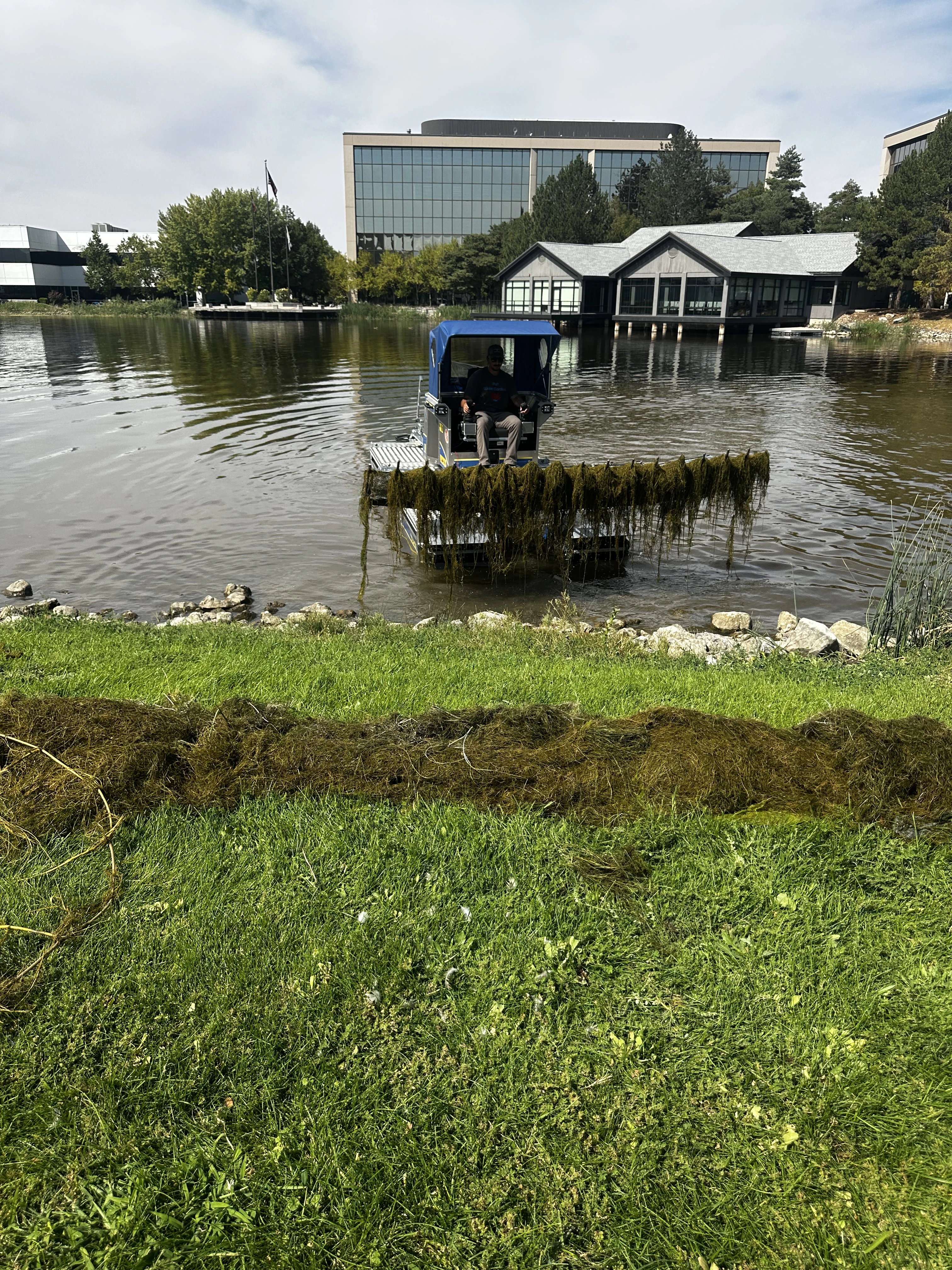
Answers about dock access, ramp clearing, timeline, and follow-up maintenance.
Shoreline access clearing is focused vegetation removal around docks, ramps, walking paths, canal inlets, and intake areas so people and equipment can safely reach the water edge again.
Yes. Dock and ramp corridor clearing is one of the most common requests. We cut and remove cattails and related growth that narrows launch lanes and blocks safe shoreline entry.
Most access-corridor projects can be reopened in a single field visit when scope is limited to targeted lanes. Larger sites with multiple blocked zones may be scheduled in phases.
The work approach is selected to minimize shoreline disturbance. We use equipment and sequencing designed for soft-bank and shallow-edge conditions where bank stability is a concern.
Usually yes. High-use shoreline corridors often regrow each season. A maintenance interval helps keep docks, ramps, and paths open instead of waiting for another full blockage.
Tell us what is growing, where it is, and how access looks. We will recommend a practical harvesting, removal, treatment, or support approach.
No generic promises. We review your site details first, then recommend a scope path that matches actual field constraints.
Request a Quote